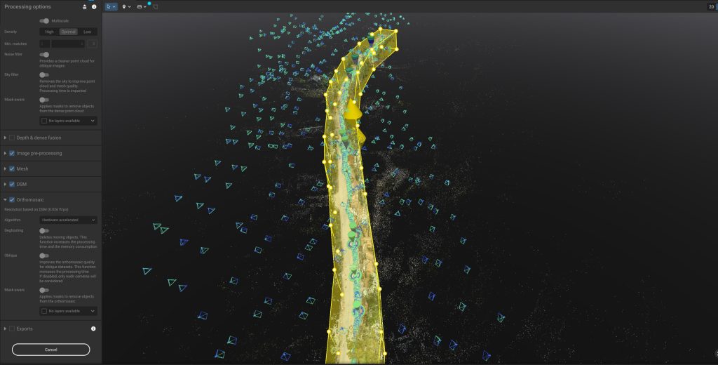
Next-Level Orthomosaic Mapping and Photogrammetry With PIX4D & EMLID Innovations
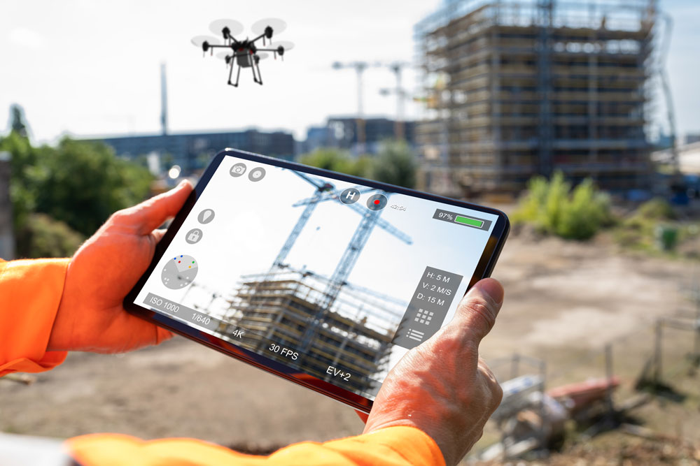
At Aerial Drone Solutions, we specialize in providing high-quality aerial and terrestrial imagery, utilizing cutting-edge PIX4D software to create accurate maps and models. Our services enhance project planning, monitoring, and documentation across various industries.
“we carry Aviation Liability with $5 million in limits”
Our Mission
At Aerial Drone Solutions, we specialize in providing high-quality aerial and terrestrial imagery, utilizing cutting-edge PIX4D software to create accurate maps and models. Our services enhance project planning, monitoring, and documentation across various industries.
At Aerial Drone Solutions, our mission is to leverage pioneering aerial drone technology to furnish our stakeholders with precise and timely information. We are committed to driving innovation, enhancing project outcomes, and ensuring success through our cutting-edge solutions. Our dedication to excellence and accuracy empowers our clients to make informed decisions, fostering growth and advancement in their endeavors.
Our Vision
At Aerial Drone Solutions, we specialize in providing high-quality aerial and terrestrial imagery, utilizing cutting-edge PIX4D software to create accurate maps and models. Our services enhance project planning, monitoring, and documentation across various industries.
Our vision is to continually discover innovative solutions utilizing aerial drone technology, providing precise and accurate information to our stakeholders, and driving success through cutting-edge advancements.